「だいち2号」の光跡(*写真右上)/ ©Hiroshi Suzuki
2016年7月19日午前0時39分。
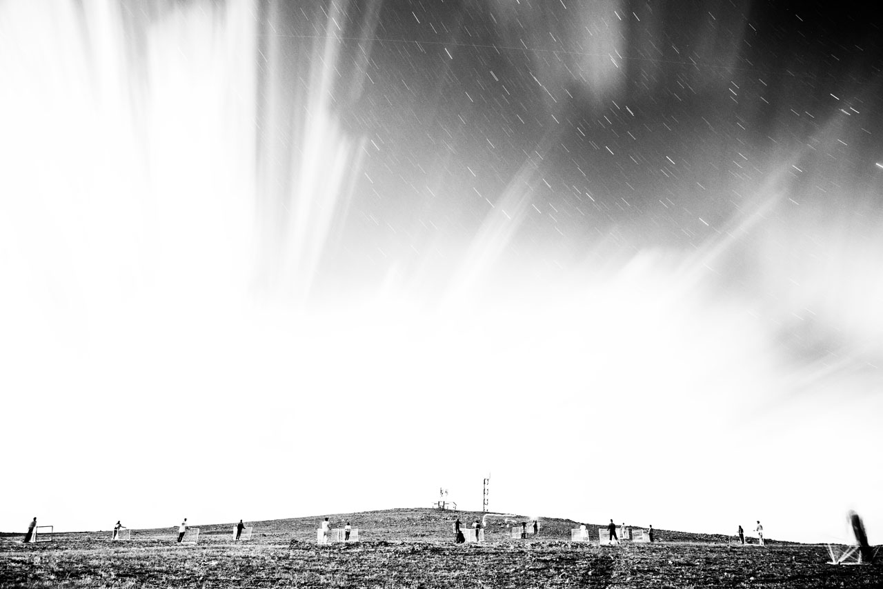
地球観測衛星「だいち2号」がモンゴルの草原の上を静かに飛んでいく。電波反射器の並んだ広場に集まった人々は、昼間の活動では見えない人工衛星の光を静かに目で追う。
本書で紹介する《だいちの星座》の作品は、一見すると〈夜空に浮かぶ星と星座〉に見えるが、JAXAが運用する「だいち2号」の観測画像を利用して制作した地上絵だ。人々が手作りの電波反射器を配置し、「だいち2号」が通過する方位に向ける。地上絵には観測されたデータと画像処理によって「1等星」や「星雲」が浮かび上がり、それらを結んだ新しい星座が地上に表れる。
0:39 a.m., July 19, 2016.
The Earth observation satellite Daichi 2 quietly flies over the Mongolian plains. Human beings, gathered in an open space lined with radio wave reflectors, silently follow with their eyes the dot of light that is the satellite, which is hidden from view during the day.
The Constellations of the Earth presented in these pages appear at first glance to be constellations of stars poised in the night sky. They are, in fact, geoglyphs – pictures drawn across the land – produced using satellite imagery captured by JAXA’s Daichi 2. People set up handmade corner reflectors, pointing them in the direction of the satellite. By applying image processing to the observation data, “first magnitude stars” and “nebulae” show up in the geoglyph, revealing constellations that take shape on the earth.
Comments are closed